Remote Sensing Resources
Remote sensing is the science and art of acquiring of information from a distance. Researchers, NASA, the military, and more, observe the Earth and other planetary bodies via remote sensors on satellites and aircraft that detect and record reflected or emitted energy. Remote sensors, which provide a global perspective and a wealth of data about Earth systems, enable data-informed decision making based on the current and future state of our planet.
Modified from NASA EARTHDATA
Want to learn more? Check out these online resources from GISGeography and CIRES (video). Also from ColoradoView and AmericaView.
Several software and cloud-based platforms exist to work with satellite imagery, LiDAR, and other datasets to perform analysis and answer questions. Here are just a few common applications for working with remotely sensed data.
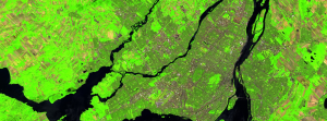
Google Earth Engine
![]()
Google Earth Engine is a free cloud-based platform for planetary-scale geospatial analysis that brings Google’s massive computational capabilities to bear on a variety of high-impact societal issues including deforestation, drought, disaster, disease, food security, water management, climate monitoring and environmental protection.
Google Earth Engine enables users to compute on petabytes of data on the fly without having the navigate the complexities of cloud-based parallelization. Enhancing inclusive access has spurred the growth of earth observation at scales previously unimaginable.
From Gorelick et al. (2017), Remote Sensing of the Environment
Learn more about GEE and what it can be used for here.
Thorough documentation and tutorials are widely available to learn how to use GEE.
Get Started with Google Earth Engine
Read the book on Cloud-Based Remote Sensing with Google Earth Engine: Fundamentals and Applications
Google Earth Engine Lessons: Self-paced content using ecological applications of remote sensing.
TerrSet Geospatial Monitoring and Modeling Software
![]()
Provided by Clark Labs, TerrSet is an integrated geospatial software system for monitoring and modeling the earth system for sustainable development. The TerrSet system incorporates the IDRISI GIS Analysis and IDRISI Image Processing tools along with a constellation of vertical applications. TerrSet offers the most extensive set of geospatial tools in the industry in a single, affordable package.
ENVI
![]()
ENVI image analysis software is used by GIS professionals, remote sensing scientists, and image analysts to extract meaningful information from imagery to make better decisions. ENVI can be deployed and accessed from the desktop, in the cloud, and on mobile devices, and can be customized through an API to meet specific project requirements.
ERDAS IMAGINE
ERDAS IMAGINE provides remote sensing, photogrammetry, LiDAR analysis, basic vector analysis, and radar processing in one product. It can perform image classification and analysis, change detection, feature extraction with machine learning and deep learning, and more.
ERDAS IMAGINE Product info and Brochure