GEOSPATIAL FACULTY
CSU faculty with specialties in geospatial sciences
Dr. Mazdak Arabi | Professor, Civil and Environmental Engineering
Dr. Arabi focuses on water resources management, including analytical and computational methods to support both deterministic and probabilistic evaluation of watershed-scale benefits of best management practices.
He teaches GIS and GPS for Engineering Applications.
Scott Carman | Assistant Professor, Landscape Architecture
Professor Carman’s research work focuses on the use of geospatial technology to understand and design complex urban social and environmental systems.
He teaches several classes which incorporate GIS and landscape architecture.
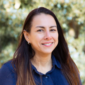
Dr. Sandra Duran | Assistant Professor, Forest and Rangeland Stewardship
Dr. Duran studies how human-caused disturbances and climate change affect the abundance and distribution of plant communities, and how changes in plant traits affect ecosystem processes and function. Specifically, her work focuses on developing new methods and elaborating theory for how functional traits can be used to “scale up” from individual to communities and ecosystems.
Visit her lab website to find out information on our recent projects along our three research themes: trait-based ecology, remote sensing of ecology, and ecosystem function.
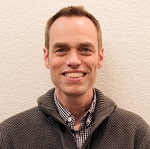
Dr. Kyle Horton | Assistant Professor, Fish, Wildlife, and Conservation Biology
Dr. Melinda Laituri | Professor Emeritus, Ecosystem Science and Sustainability
While Dr. Laituri is now retired, she remains a part of the Geospatial Centroid.
In addition to being founder and director of the Geospatial Centroid @ CSU for many years, Dr. Laituri was a professor in the Warner College ESS department. Her research interests are diverse, having worked with indigenous peoples throughout the world on issues related to natural resource management, disaster adaptation, and water resource issues using geographic information systems (GIS) that utilize cultural and eco-physical data in research models.
A key focus is participatory GIS where indigenous peoples develop spatial information and maps essential for the management of their own resources. Other research work focuses on the role of the Internet and geospatial technologies in disaster management and cross-cultural environmental histories of river basin management.
Dr. Stephen Leisz | Associate Professor, Anthropology and Geography
Professor Stephen Leisz has worked with GI- related projects and taught GIS and remote sensing since 1991. His work focuses on applying GIS to the social sciences and monitoring and exploring the drivers of land-use/land-cover changes. Since 2011, he has been collaborating with archaeologists to apply GIS and remote sensing to archaeological field work.
Dr. Leisz teaches Mapping, Cartography, and Spatial Thinking, Remote Sensing and Image Interpretation (GR 323 and GR 503), Spatial Analysis with GIS, and Land Change Science and Remote Sensing.
He is also the director of the Land Change Science and Remote Sensing Laboratory, and Co-Director of both The Center for Archaeology and Remote Sensing and The Earth Archive.
Dr. Sheryl Magzamen | Associate Professor, Environmental and Radiological Health Sciences
Sheryl’s research focuses on the relative contribution of social factors and environmental exposures to chronic disease, with a focus on respiratory disease. Her GIS-based work focuses on environmental exposure assessment at the individual, household and community level, and integration of secondary data sources (e.g., Census) for multilevel modeling of disease risk factors and exposure mixtures.
Dr. Magzamen teaches ERHS 538 (Geographic Information Systems and Health) with Dr. Molly Gutilla of the Colorado School of Public Health in spring semesters of even years.
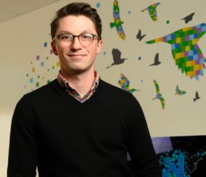
Dr. Matthew Ross | Assistant Professor, Ecosystem Science and Sustainability, Director of the Geospatial Centroid
Dr. Ross is an ecosystem scientist with a focus on water quality. He uses a range of approaches from remote sensing to intensive field sampling, utilizing R statistical language, to explore how people control and change the environment and how altered landscapes impact the streams and rivers that drain them.
Matt is currently working on projects such as remote sensing of water quality nationwide, and water quality legacies of mining operations. He teaches Land Use and Water Quality, and Data Issues in Hydrology.
Learn more about his research at rossyndicate.com.
Elizabeth Tulanowski | Instructor, Ecosystem Science and Sustainability
Elizabeth is a GIS instructor based out the Warner College of Natural Resources – ESS Department. Her areas of geospatial expertise include the ArcGIS suite of software, spatial analysis, Python programming for GIS, and field data collection methods with GPS. While her focus is teaching geospatial science, she also administers the WCNR GIS Minor, mentors and advises students in their own geospatial education and research, and is the Education Coordinator for the Centroid organizing seminars and workshops.
She teaches Introduction to GIS, Programming for GIS, and the Seminar on GIS and Remote Sensing Applications for Natural Resources, a Geospatial Project course, and Geospatial Field Methods for Natural Resources.
Dr. Yu Wei | Professor, Forest and Rangeland Stewardship
Dr. Wei’s research focuses on data-driven decision making, using spatially explicit optimization, machine learning, and systems analysis for applications in landscape-level forest management and wildland fire decision support.
He teaches several courses, including GIS Applications for Natural Resources Management.
Learn more about Dr. Wei at his website.
Dr. George Wittemyer | Professor, Fish, Wildlife, and Conservation Biology
Professor Wittemyer’s work focuses on investigating spatial factors that structure wildlife populations. He and his research lab work to determine how landscapes, humans, and climate impact demography, distribution, behavior and movement of at-risk wildlife populations, and translate their research into policy actions.
George also serves as the Chair of the Scientific Board of Save the Elephants, and initiated the location-based individual monitoring project of the Samburu Elephant Population in Kenya.
Professor Wittemyer teaches courses in wildlife management and conservation. Learn more about his work and his students on his research lab page.
Dr. Jody Vogeler | Research Scientist, Natural Resources Ecology Laboratory
Dr. Vogeler is a Research Scientist with the Natural Resource Ecology Laboratory (NREL) and Assistant Professor with the Dept. of Ecosystem Science and Sustainability, focusing entirely on research.
Her lab in NREL utilizes a variety of remote sensing data sources (e.g lidar, Landsat time series, SAR), supplemented with field-based surveys, to address ecological questions at varying spatial and temporal resolutions and extents related to forest disturbance dynamics, wildlife habitat ecology, assessing resistance and resilience within various ecosystems, and translating research results into management relevant information.
Learn more about Dr. Vogeler’s work on her research page.
Get in touch with the Geospatial Centroid.
Contact us for project support, Geospatial Help Desk assistance, training opportunities, internships or other ways to get more involved with the Centroid.
Email: gis@colostate.edu
Phone: 970.491.2774
Listserv: Sign up for GEOSPATIAL listserv