| 3D Geology/Owl Canyon |
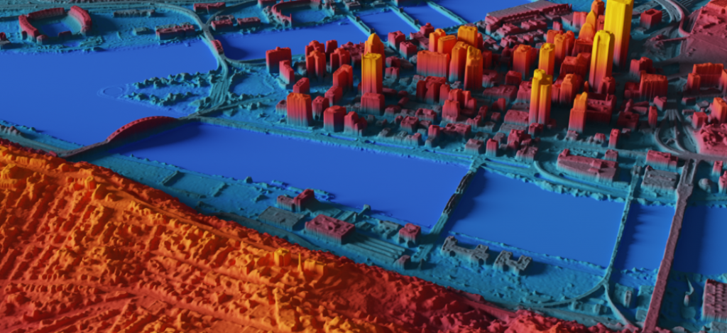
| 3D printing/GIS layers: 3D landscapes and projected GIS layers for CSU Mountain Campus |
| Affordable Housing |
| Sandbox Solar: Potential for Agrivoltaics in 5 CO Counties/Ag Land within 5 miles of substation |
| Algae Production Maps |
| Alt Trans: Facilities “zones” |
| Alt Trans: Interactive form for Injury mapping |
| Alternative Transportation Protocols |
| Antarctica Maps |
| Antarctica Photos |
| AQUASAT |
| ArcGIS Hub |
| Aspen Valley Land Trust |
| Biofuels Potential |
| Bird Survey Data: US and Europe |
| Bohemian: Community Indicator Catalog |
| Brightfields: Contributions towards data gathering, processing, analysis |
| Bundy Map: Chuck Herrick |
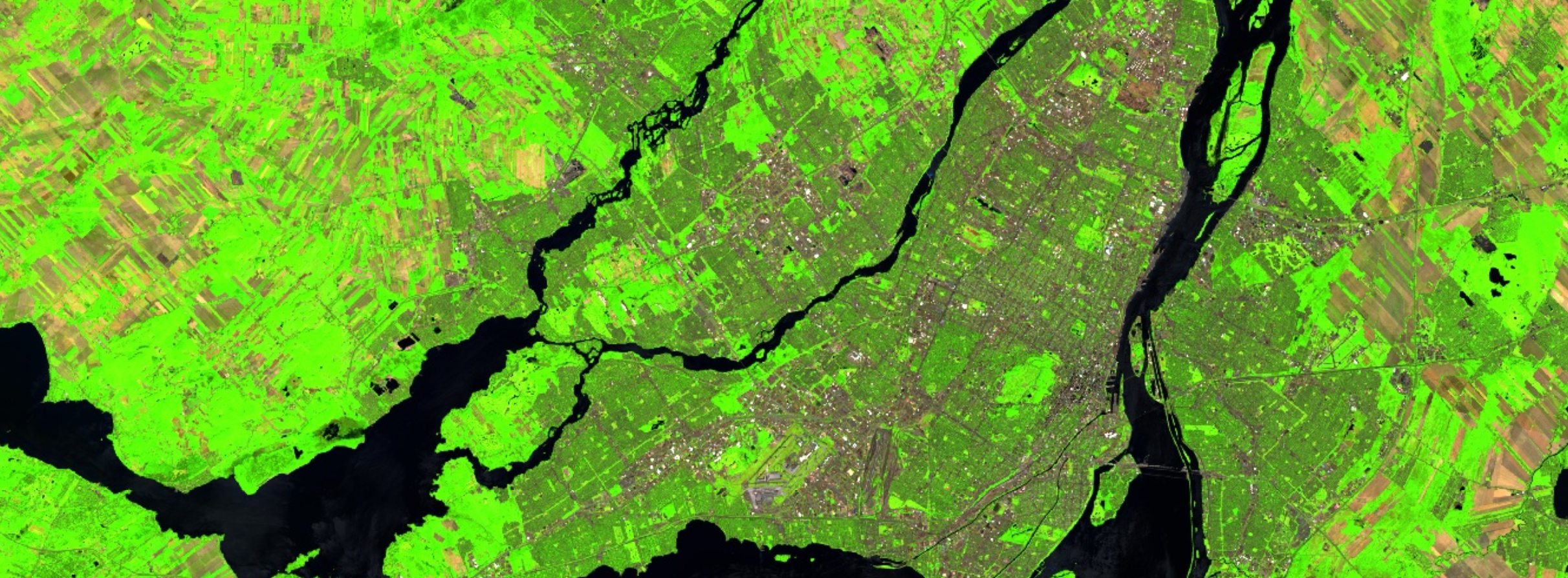
| Cache La Poudre (ongoing) / Poudre Portal |
| Calculating distances between house sale locations and NPS boundaries and other features |
| Cameron Peak Story Map (CPRW) |
| Campus Food Map |
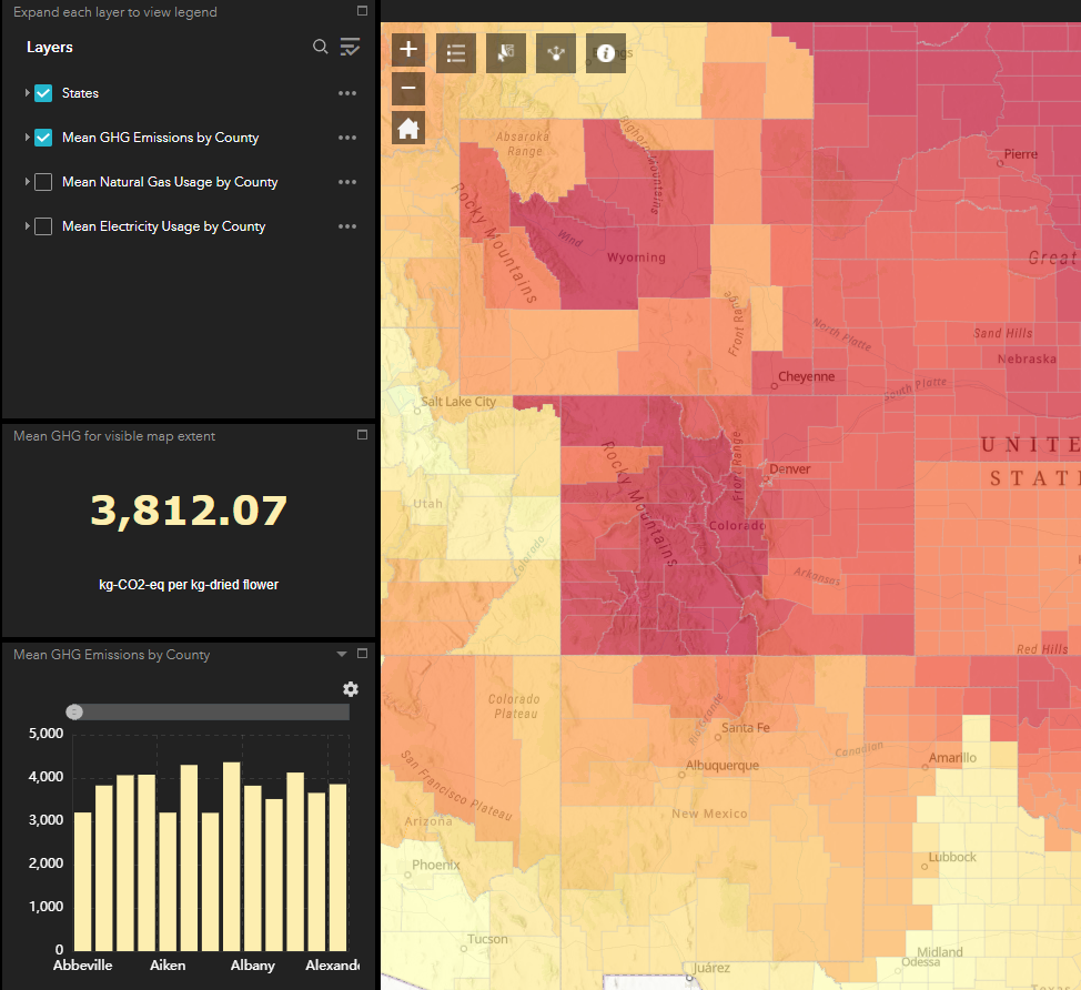
| Cannabis Carbon Emission |
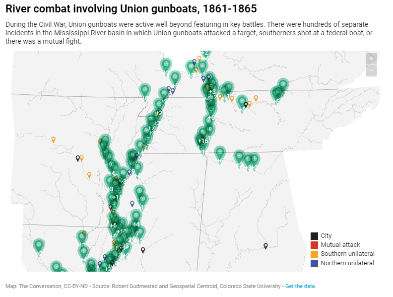
| CARTOGRAPHY: Civil War Gunboats – Gudmestad |
| CARTOGRAPHY: Italians in Southeast US |
| Cartography: Longs Peak/RMNP for Ruth Alexander |
| CARTOGRAPHY: Maps for EJ in the Anthropocene Book |
| CARTOGRAPHY: Medieval France |
| CARTOGRAPHY: TWP, Equity issues |
| CCC Atlas |
| CCC Watershed Banks, Western States |
| CEMML: Vegetation Mapping |
| Chattanooga Project |
| Cherokee Ranch project |
| Clery Act: Reporting Maps |
| College of Agriculture: mapping student retention |
| Colorado Headwaters |
| Colorado River Basin |
| ColoradoView: Grasslands |
| ColoradoView: Grazing Lands |
| ColoradoView: Invasive Species |
| ColoradoView: UV-B |
| COMaP: Data Updates, Distribution (past versions) |
| Compile Mountain Campus Dataset |
| Covid Oral Histories: Story Map support |
| CPF Water Quality |
| Crime mapping; data processing and mapping of crime statistics on reservation |
| CSU Addresses |
| CSU Affordable Housing Task Force: spatial analysis on housing cost vs salaries for CSU employees |
| CSU Development Office |
| CSU Extension: Cary Weiner |
| CSU Online Education |
| CSU Parking and Transportation Services/Alternative Transportation |
| Dugan Lake Superior (UW-Madison) |
| Elk Mapping in Rocky Mountain National Park |
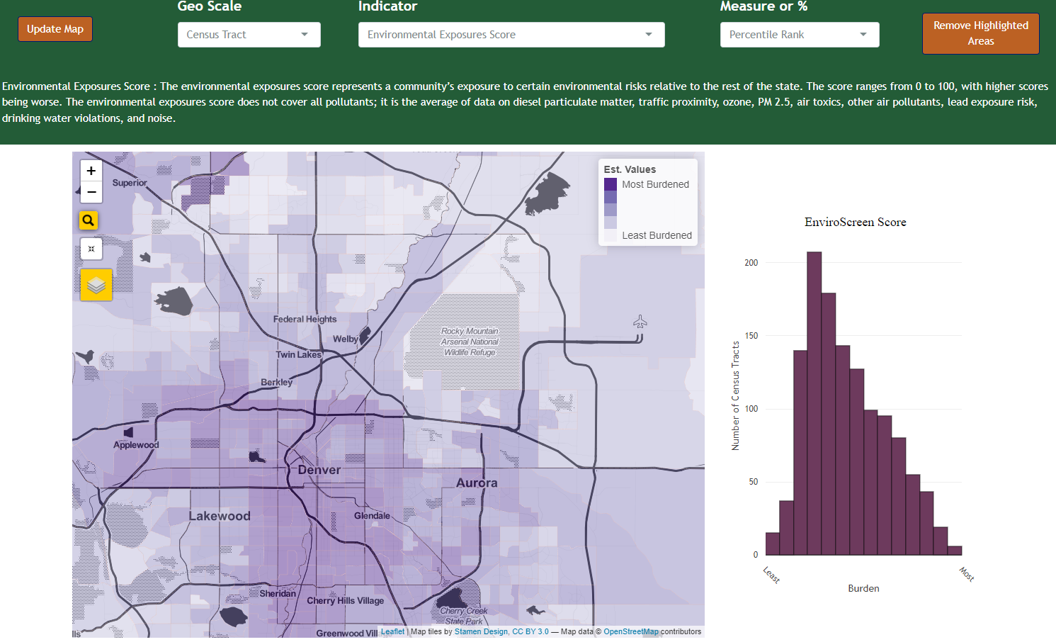
| EnviroScreen |
| Estimating seagrass coverage using drone imagery, Kalamos, Greece |
| Ethiopia Lesson Rewrite |
| Everitt Real Estate Center: forecast maps; sales in 3-county region; development forecasts |
| CSU Extension: Outreach to Indigenous Populations |
| Food Access in Fort Collins (Bohemian Foundation) |
| Fraser Experimental Forest |
| FWCB (Gail Dethloff): Interactive Maps |
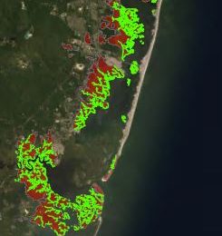
| FWS Shoreline Mapping |
| Georeferencing Historic Maps |
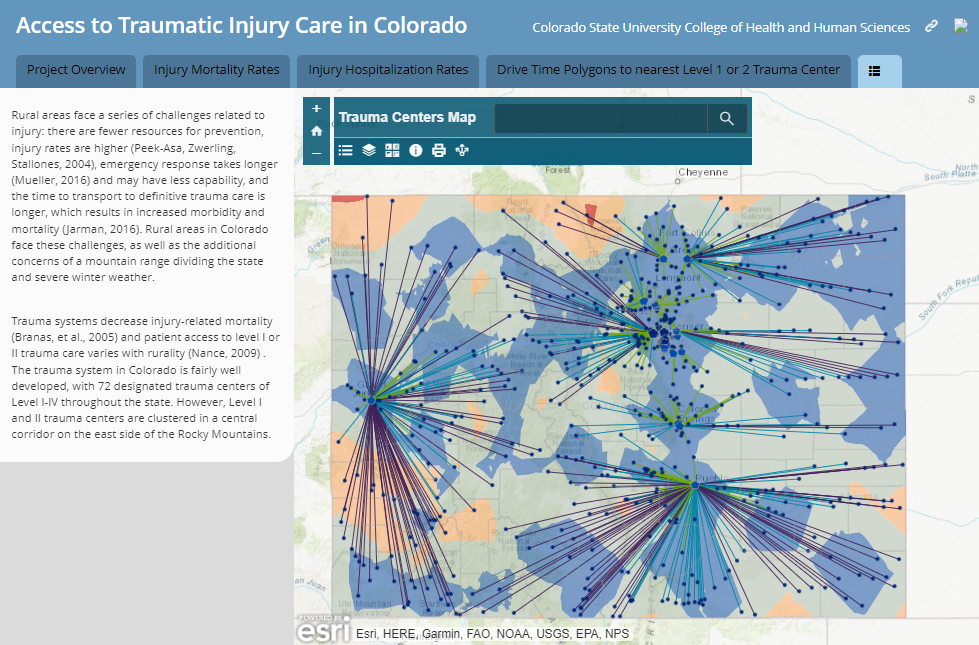
| GIS in Health: Aligning census data with field observation data; distance to trauma centers in CO |
| GMSO Story Maps / National Western Center |
| Google Liquid Galaxy presentation |
| Headwaters datasets, CLP as template |
| Heatmap of Student Addresses |
| HICAHS: Mapping results of agricultural safety trainings in three western states |
| High-Tech Trees |
| IBE-Regional Sustainability Lit Review and Data Dictionary (SRS-RN) |
| Institutional Research: First Generation Students |
| Institutional Research: Graduation Rates |
| Institutional Research: SocioEcon Data for CSU Students |
| International Workshops – Todos Santos |
| Just Transitions: Story Map Support |
| Kalamos: Database/File Organization |
| Kenya (Pat Keys): Forest Change over Time – R Shiny app |
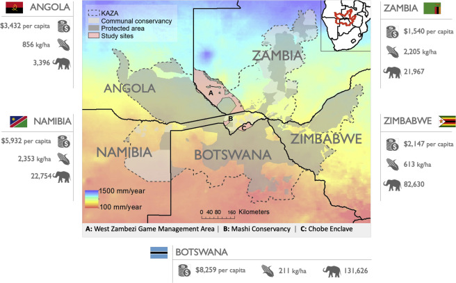
| Kenya Wildlife Conservancies |
| Lake Tahoe Art Project |
| Larimer County DNR: Small Grant Story Map |
| Larimer/Weld Real Estate Forecast |
| Map of Cebu, Philippines |
| Mapillary |
| Materials Mapping/Radical Atlas of Ceramics |
| McKee Wellness Walk |
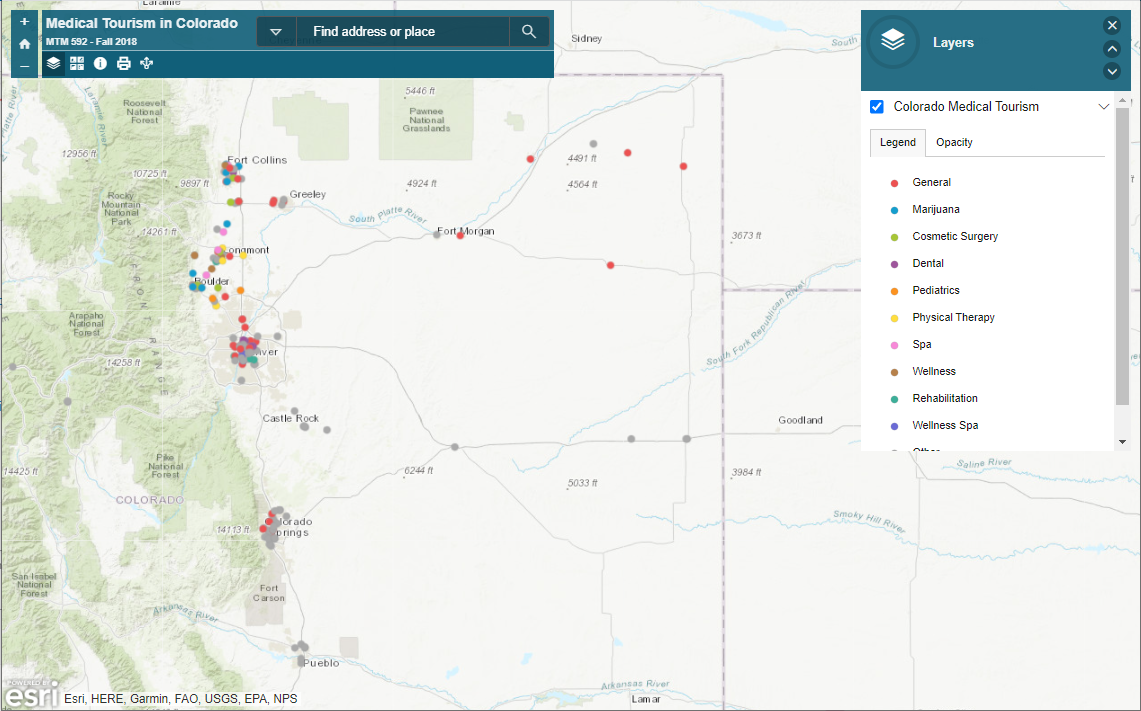
| Medical Tourism in Colorado |
| Mexico Protected Areas |
| Minneapolis/Racine children LEAD exposure |
| Mountain Sentinels |
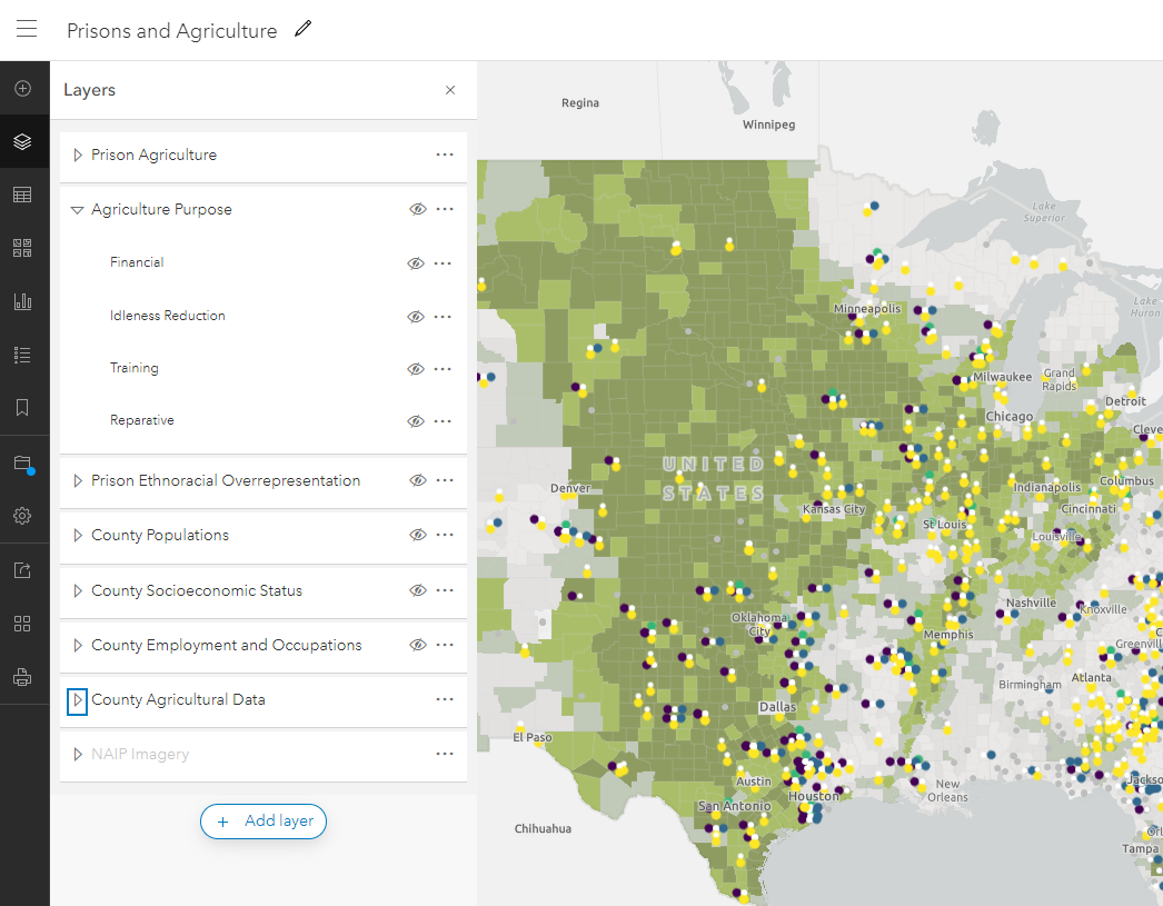
| NASA: Prison Agriculture |
| National Park Service – Land Resources Division: depicting land ownership, uses and legal boundaries |
| National Park Service: Guadalupe Mountains National Park. Digitizing legacy vegetation maps |
| Nightlights during COVID |
| NoCo Commuter Rail |
| NPS: Chamizal |
| NPS: Cultural Resources – Guadalupe Mtns Vegetation Maps |
| NPS: Cultural Resources – Cultural Database (Heidi O) |
| NPS: Land Resources Division |
| NPS: Park Vulnerability to Climate Change (Water) |
| NPS: ROMO – Campgrounds |
| NPS-CIOSU: Capitol Reef (CARE) Social Trails |
| NPS-CIOSU: Wildlife in Intermountain Region Parks |
| Oil and Gas: Estimating carbon sequestration around old wells |
| PBGJAM |
| Pingree Map App |
| Poudre River Flythrough (GLG) |
| Poudre River WQ project |
| Poudre Valley Farm Cooperative |
| Prisons and Agriculture |
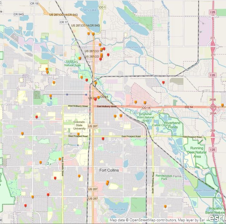
| PTS: Crowdsource Reporter Tool – Vision Zero |
| PTS: Road Priorities |
| Pulse Crop Mapping |
| Pulse Crop Survey and GIS layers: Jessica Davis |
| Quitobaquito Maps |
| Rachel Carson Center alumni map |
| Regional Bike Maps |
| Rio Grande River Basin: Compiling spatial database for watershed |
| Rochester: Census Block Spatial Join |
| Rwanda Microgrid |
| SDG land cover classification for Danielle Davis |
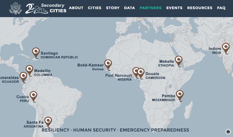
| Secondary Cities |
| Secondary Cities: Water Fellowship |
| Semester at Sea/Database of Resources |
| Semester at Sea/On-Campus Course Support |
| Shambhala Mountain Center: Creating geodatabase of existing data |
| Shambhala: Master Plan Amendment Maps |
| Socioeco Data for Grant App |
| The Group: Real Estate/GLG |
| The Nature Conservancy – Global Lands Team; oil/gas distribution; Rwanda gorillas/poaching |
| TILT: Horticulture |
| TILT: Mosquitos |
| TILT: Pingree Park |
| TNC: Riparian/NAIP classification |
| TNC: TNC Global (Jim Oakleaf) |
| TNC: TNC Global Lands: Rwanda Gorillas |
| Todos Santos Data and Story Map |
| Update Food Justice Web Map |
| Update map for Nicole Archambeau |
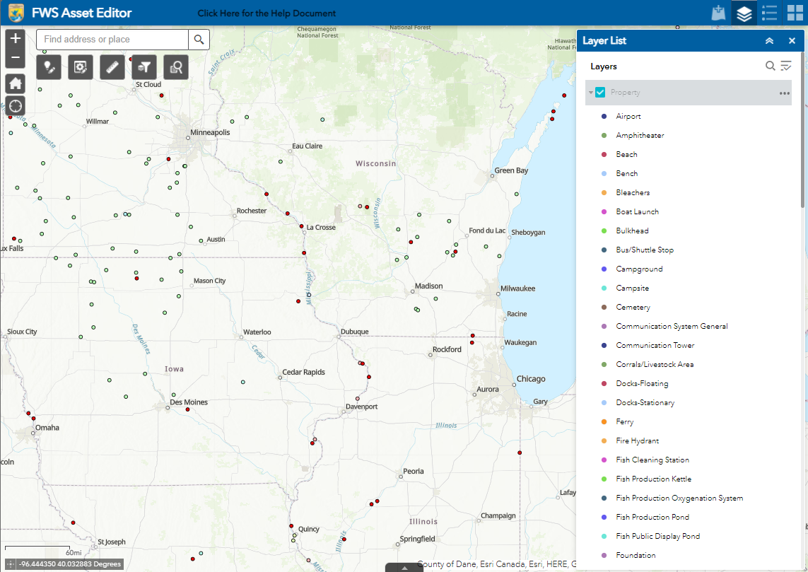
| USFWS – Amenities at National Wildlife Refuges |
| USFWS: John Guinotte |
| Water Affordability (Duke) |
| Watershed Data Hub: organize and publish multiple spatial data layers for four watersheds in the West |
| Woodward Employees |
| CARTOGRAPHY: Zebulon Pike Maps |